


 Sign In / Register
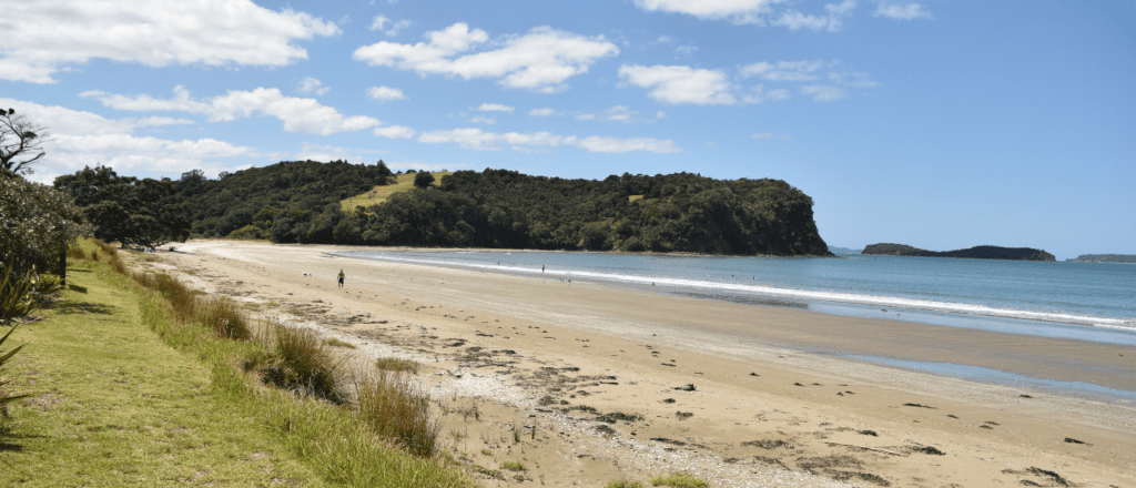


Profile
Mahurangi Regional Park spans across the Puhoi River, north of Wenderholm, and along Te Muri Beach to Sullivans Bay and Mita Bay.
How to get to Mahurangi
Mahurangi West: Drive north on State Highway 1. About 6km past Wenderholm Regional Park, turn right into Mahurangi West Road then right into Ngarewa Drive and follow to the end of the road.
Scott point: Take State Highway 1 to Warkworth and follow the signs to Snells Beach. Approximately 1km past Snells Beach, turn right into Ridge Road and follow to the end of the road.
Access issues: Mahurangi East (Including Lagoon Bay and Big Bay) has no road access. Access is by boat only.
History
Māori lived here in large communities. The park was the ancestral domain of Ngāti Rongo and there are four fortified pa sites at Opahi, Cudlip and Te Muri Points and above Sullivan’s Bay.
A sea captain, John Sullivan, married Merehai Kaipuke and settled at Otarawao (Sullivan’s Bay) in the 1870s. Their descendents farmed the land for nearly a century and farming continues on the park today.
More than 100 Māori and European settlers are buried in the Te Muri urupa (cemetery) on the park. The urupa was established in the 1860s alongside two sacred (tapu) pōhutukawa trees.
Scott Homestead, at Scott Point, is a reminder of the Mahurangi Harbour’s busy past as a hub of timber milling, shipbuilding, firewood cutting and trade. Thomas Scott Jr built the Georgian style house in 1877 on the site where his father,a shipbuilder, ran an inn until it was destroyed by fire. Volunteers have lovingly restored the house and its surrounds.
See more about dog walking restrictions, tracks, park facilities and activities at regionalparks.aucklandcouncil.govt.nz/mahurangi
The photo above is of Te Muri Beach.
Map
Sorry, no records were found. Please adjust your search criteria and try again.
Sorry, unable to load the Maps API.


Comments
You must be signed in to leave a comment